

The original lagoon: extent, canals, ponds, fauna and flora of the Lagoa de Antela
What the Lagoa de Antela was like before 1958: a shallow sheet of water 7 by 6 kilometres, with canals and ponds, water birds, leeches, rushes and some fifty villages around it.
- Size
- about 7 km long by 6 wide in floods
- Altitude
- 610–615 m
- Depth
- average 0.6 m and pools up to 3 m
- Official area (1962)
- 3,244 ha
The Lagoa de Antela was not a lake with fixed edges but a wetland that breathed with the seasons. This page describes what it was like before the works of the Instituto Nacional de Colonización dried it from 1958 (the history of those works is in The draining of the Lagoa de Antela) and what life concentrated in and around its waters.
A shallow lake that grew in winter
According to the historian Edelmiro Martínez Cerredelo, the lagoon had a perimeter of about thirty-five kilometres, about seven long by six wide and a water surface of around forty-five square kilometres [1]. The plain is at about 610 metres altitude and is so flat that technicians found only 84 centimetres of height difference: 610.42 metres in the Vilar de Barrio area and 609.58 at the N-525 canal bridge [1]. The Galipedia gives an average depth of 0.60 metres, with pools up to 3 [2].
The area figures vary by source (from 3,244 to 4,000 hectares); the Greenpeace dossier estimates about 3,500 ha in winter floods and 1,400 in summer, and about 7,700 ha and 1,650 if the flood plains of the Antela, Limia, Fírbeda, Viduedo, Faramontaos, Nocelo, Trasmiras and Rego da Veiga rivers are added, in a wetland complex of around 30,000 hectares on the plain of A Limia [3]. See the note on the discrepancy on the main page.
A tectonic depression inherited from the Tertiary
The depression of A Limia was born in the Tertiary through the movement of crustal blocks: some rose and formed ranges such as Queixa or San Mamede; others sank and created tectonic depressions such as Maceda, A Limia or Monterrei [2]. Almost all the lagoons of that era silted up over time; Antela was the one that survived into the 20th century [2].
Canals and ponds
In summer the water sheet broke up into ponds and rush beds [1][2]. The main channel was the outlet carrying water towards Ponte Liñares, where the Limia river passed through a small gorge blocked by a mass of rock that held back the waters [5]. The Galipedia records the tradition that the Romans, in the first third of the 2nd century under the emperor Hadrian, opened a main outlet about 26 kilometres long and 17 metres wide, from Vilar de Barrio to Ponte Liñares, and a network of small channels; the modern canal would follow the same route [2]. Elixio Rivas and Conde-Valvís place this work between the years 117 and 138 and link it with the nickname "Golden Straw" for A Limia [1].
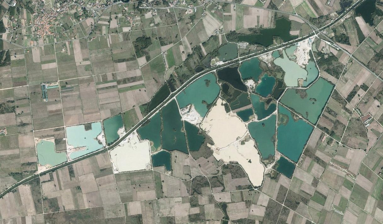
Since 1972 the sand pits opened in Sandiás and Xinzo have created new ponds in the area of the old lagoon [2]; their present role is in The Lagoa de Antela today.
Life in the water
The lagoon was a stopover and wintering place for thousands of water birds that used it all year round and, in winter, for migratory species fleeing the cold of northern Europe [1]. The Greenpeace dossier recalls that the draining caused the extinction of the greylag goose as a breeding bird in the Iberian Peninsula and of ten other birds as breeders in Galicia [3]. Among the marsh vegetation, the canon Juan Manuel Bedoya described in 1831 rushes, algae, bulrushes and reeds in greenish, muddy waters [4]. The bión (or beón), a kind of rush, is a word still alive in A Limia and gave its name to "Lake Beón" [1].
Life around the lagoon
Around the water lived some fifty villages and towns that used the bión as bedding for the stables and the lagoon for hunting ducks, gathering birds’ eggs and catching fish, leeches and frogs [1]. Leeches were a business in the 18th and 19th centuries: the Galipedia says they were a source of income for A Limia [2]. The lagoon’s meadows served as summer and autumn pasture for livestock [3].
Drowned cities and mosquitoes
Oral tradition fills the lagoon with tales: the city of Antioquía, flooded as punishment for idolising the cockerel, and the mosquitoes, said to be King Arthur and his enchanted soldiers on that plain [2]. See Antioquía, the drowned city. Archaeology adds the lake-dwelling villages (pile dwellings) studied by Conde-Valvís in the 1950s: three villages of 58, 56 and 36 dwellings, the "cortellos", between Sandiás and Cortegada [2]. The website Via Auria records that scholars also cited dugout-trunk boats, polished stone industry, Roman-era canals, steles and altars, remains that the excavators of the late 1950s may have wiped out [6].
Links
- The Lagoa de Antela in figures
- Lagoa de Antela
- The draining of the Lagoa de Antela
- Memory and testimonies
- Ponds and birds of the Lagoa de Antela
- Nature of A Limia
Sources
- Edelmiro Martínez Cerredelo, «A lagoa de Antela ou lago Beón na Limia», Historia de Xinzo, 22-02-2014. https://historiadexinzo.wordpress.com/2014/02/22/a-lagoa-de-antela/
- «Lagoa de Antela», Galipedia (CC BY-SA 4.0). https://gl.wikipedia.org/wiki/Lagoa_de_Antela
- Greenpeace España, dossier «Tres lagunas», marzo de 2026. https://es.greenpeace.org/es/wp-content/uploads/sites/3/2026/03/dossier-tres-lagunas_.pdf
- lagoadeantela.es, «Intentos de desecación de la laguna de Antela» (cita a Bedoya, 1831). https://lagoadeantela.es/intentos-de-desecacion-laguna-antela/
- Edelmiro Martínez Cerredelo, «Os sete malogrados intentos de desecamento da Lagoa de Antela no século XIX», Historia de Xinzo, 31-08-2018 (descrición do punto de Ponte Liñares). https://historiadexinzo.wordpress.com/2018/08/31/os-sete-malogrados-intentos-de-desecamento-da-lagoa-de-antela-no-seculo-xix/
- «A Limia Alta. A lagoa de Antela ou Lago Beón», Via Auria, 2008. Arquivo web (03-07-2009): https://web.archive.org/web/20090703091135/http://www.viaauria.es/presentacion/Galicia/ourense/rutasou/alimia/lagoaantela.htm
- «Via Auria | Lagoa de Antela | Limia Alta». https://web.archive.org/web/20090703091135/http://www.viaauria.es/presentacion/Galicia/ourense/rutasou/alimia/lagoaantela.htm
You may also like
 Lagoa de AntelaThe Lagoa de Antela in figures: area, water and habitatsSources give very different areas for the Lagoa de Antela, from 2,630 to 5,870 ha. This page gathers the estimates, the seasonal flooding…
Lagoa de AntelaThe 1956 Law and the drainage project of AntelaHow the Law of 27 December 1956 and Francisco Zapata Tejedor's project led to the draining of Antela: phases, works from 1958, the 1962…
Lagoa de AntelaLegislation on the Lagoa de Antela (1868–2002)Chronology of the rules of the Gaceta de Madrid, BOE and DOG on the draining of Antela: concessions from 1868 to 1907, the 1918 law, the…
Lagoa de AntelaThe leeches of the Lagoa de AntelaIn the 19th century the Lagoa de Antela was a leech breeding ground famous in Spain: a factory exported to France, catching ended up…
Lagoa de AntelaThe SGHN Antela Section: wetlands, lapwings and water liliesSince 2011 the SGHN Antela Section has been restoring meadows and ponds in A Limia: the Antonio Villarino Wetland at Vilaseca, the Veiga de…
Lagoa de AntelaMemory and testimonies of the draining of the Lagoa de AntelaWhat the people of A Limia say about the draining of the Lagoa de Antela: who gained plots and work, who lost pasture, bión and birds, and…
