

Antela: the 1956 Plan and why the drainage was a hydraulic failure
The analysis by geographers of the University of Oviedo on Antela's drainage: the 1958-1963 works, the Arnoia irrigation never built, technical errors, loss of biodiversity and the potato monoculture.
- Main source
- Fernández Soto et al., BAGE no. 57 (2011)
- Law
- 1956 (high national interest)
- Drainage works
- 1958-1963
- Lake area
- c. 3,600 ha
An article by four geographers of the University of Oviedo describes the drainage of the Lagoa de Antela as "one of the great fiascos in the history of Spanish hydraulic works". It is a critical reading, which this page summarises attributing each judgment to its authors, and complements The drainage of the Lagoa de Antela [1].
The lake before the works
The lake covered some 3,600 hectares between the concellos of Vilar de Barrio, Sarreaus, Xinzo de Limia, Vilar de Santos, Sandiás and Xunqueira de Ambía, at the centre of a tectonic depression at about 600 m altitude surrounded by the ranges of San Mamede, Queixa, Larouco and Pena. In winter it could be 7 km long and 6 wide, and in summer it broke up into pools and rush beds; the average depth was 0.5 to 2 m, with pools of up to 3 m. It was fed by rain, groundwater and intermittent streams such as those of Piñeira and Sandiás, and only a small part drained to the Limia through the Antela outlet, 7 km long, a narrowing that explained the partial endorheism. The authors stress the variety of ecosystems: shallow waters, rush beds and reedbeds, riverside woodland with alders and poplars, large pasture meadows and groves of oaks and chestnuts [1].
The background
The first attempt dates from 1827, by Royal Order; works began, as stretches of the canal show, but were abandoned. In 1868 the concession was given to a company that had to give up because of political instability and opposition from neighbouring communities, and in 1949 the company Agrícola de Antela S.A. was created, which withdrew over internal conflicts and problems with the concession. Private initiative was scarce because it doubted viability and could not bear the investment. In 1956 the regime decided that the State would carry out the works and promulgated a law declaring them of "high national interest". The reasons given were to obtain land to settle peasant families, especially those displaced by the hydroelectric reservoirs of Lugo and Ourense, and to remove a source of insalubrity, although, according to the authors, its relation to disease had not been scientifically proved [1].
The Coordinated Plan
The plan foresaw three phases: drain, irrigate and parcel out for settlers, housed in a new village called Antela [1].
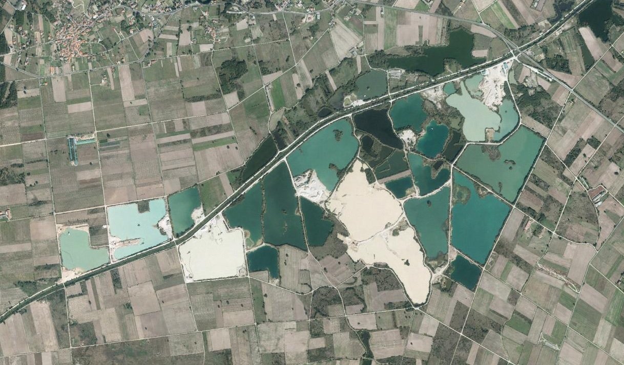
- Drainage (1958-1963): a drainage canal with two branches, 11 km long, 4 to 9 m wide and 15 to 25 m³/s; the outlet was channelled to 17 m wide (30 m³/s, 7.5 km) and the Limia, 5 km at 34 m wide (60 m³/s), with straightening of the meanders. New bridges were built.
- Irrigation (never carried out): a 78 m dam on the Arnoia, near Riobó (44 hm³, 175 ha flooded), a 9 km aqueduct with 1.8 km of tunnel at Vilar de Barrio and two perimeter canals, Xinzo’s (4,500 ha, on the left bank) and Sandiás’s (another 4,500 ha), to irrigate about 9,000 ha. Only the dam’s service road was laid out. A group of owners of the Irrigators’ Community of the Antela Zone installed pumping stations to irrigate about 600 ha by sprinkler.
- Colonisation: the parcelled land was not handed to outside settlers nor was the village founded; the plots were sold at low prices to local peasants, and the income, according to some sources, was 3 % of the cost [1].
Why it failed
The authors point to these causes, among others [1]:
- Hasty prior studies, with no rigour on soil and climate. Limia’s climate is continental, above 600 m, with a long winter and a frost-free period from May to October.
- A very sandy soil: without clay, the lake bed leaches nutrients and does not retain water. The canal was dug too deep, and the water table dropped in summer to 1.5-2.5 m, out of reach of most roots, and, paradoxically, the narrow canals did not drain the land in winter, so it kept flooding.
- Erosion and silting: the very straight, deep and narrow canal gave the water great erosive power, which cut down the bed and undermined the banks of the outlet and the Limia; there was dredging, widening of the outlet and a step in the Limia, and floods went from gradual to sudden.
- Cost overruns that exhausted the money for later phases.
Environmental and agrarian consequences
The lake’s disappearance meant, according to the authors, the loss of 11 breeding bird species in Galicia and of the last breeding population of greylag goose (Anser anser) in Spain (other pages on this site speak of ten species; the figure depends on the source). Riverside woods and many hedges were also destroyed, and subsistence polyculture gave way to a potato monoculture for the market, which depends on prices, demands much fertiliser and left the cortiñas, chestnut groves, meadows and hill abandoned. The authors maintain that the social benefit was small and that it favoured only some groups tied to the potato [1].
Later, the Ministry of Agriculture’s "Irrigation Improvement and Modernisation Project" (2005-2006) optimised the existing pumping. In 2002 the Xunta drew up a project to convert 2,000 ha of dry land to irrigation by extracting water from the lake’s aquifer, opposed by the Galician Natural History Society over risks of subsidence, harm to river flows and effects on the SPA "A Limia" and the SCI "Veiga de Ponteliñares"; the piping work and extraction wells at about 70 m began in 2003 [1]. See The Lagoa de Antela today and Water, nitrates and irrigation.
Links
- Lagoa de Antela
- The drainage of the Lagoa de Antela
- The Lagoa de Antela today
- Memory and testimonies
Sources
- Fernández Soto, Manuel; Fernández García, Aladino; Fernández Cuesta, Gaspar; Fernández Prieto, José Ramón: «La desecación de la laguna de Antela», BAGE. Boletín de la Asociación de Geógrafos Españoles, n.º 57, 2011, pp. 295-312. https://dialnet.unirioja.es/servlet/articulo?codigo=3814326
You may also like
 Lagoa de AntelaThe original lagoon: extent, canals, ponds, fauna and flora of the Lagoa de AntelaWhat the Lagoa de Antela was like before 1958: a shallow sheet of water 7 by 6 kilometres, with canals and ponds, water birds, leeches,…
Lagoa de AntelaThe draining of the Lagoa de Antela: from the 18th-century projects to the works of 1958A documented chronology of the attempts to drain the Lagoa de Antela: Toubes (1827), Pelayo Cuesta, the Mugártegui, Iscar, Stone and…
Lagoa de AntelaThe Lagoa de Antela in figures: area, water and habitatsSources give very different areas for the Lagoa de Antela, from 2,630 to 5,870 ha. This page gathers the estimates, the seasonal flooding…
Lagoa de AntelaThe 1956 Law and the drainage project of AntelaHow the Law of 27 December 1956 and Francisco Zapata Tejedor's project led to the draining of Antela: phases, works from 1958, the 1962…
Lagoa de AntelaLegislation on the Lagoa de Antela (1868–2002)Chronology of the rules of the Gaceta de Madrid, BOE and DOG on the draining of Antela: concessions from 1868 to 1907, the 1918 law, the…
Lagoa de AntelaThe leeches of the Lagoa de AntelaIn the 19th century the Lagoa de Antela was a leech breeding ground famous in Spain: a factory exported to France, catching ended up…
